Tuesday 3 July 2012

Extra-curricular Walktivity

As our traverse of the Fife Coastal Path nears it's conclusion, we have been contemplating what's going to be the nest phase of 'Operation Gut-Buster'.  Well, I say contemplating, basically I'm being told what's next, which is ok with me, it doesn't then give me the option of lobbying for the easy way out! Once the path is finished (the next stage is Elie - St. Andrews which kicks off on Sunday - stay tuned!) Ian's plan is to start working our way up some hills.

It was with this in mind that we took our first major non-path walk on Friday, when we made the short trip over the border into Clackmannanshire with a view to walking from Dollar to Glendevon. It was a day full of portent, as if there was a cosmic overlord looking down on me saying "yeah, I'm going to beast you".  When I left home to go and pick up my comrades in arms (or should that be comrades in feet?) the sun shone, the birds sang, all was well with the world. When I picked them up, it had clouded over, but still looked ok. Even when we parked up in Dollar, it looked like it was going to be a decent day.

Then the walk started, and I was plunged into a special circle of Hell, reserved for salad-dodgers.  It's been a recurring theme from my coastal walks that they always seem to finish uphill.  Clackmannanshire must be the opposite, because this started with a climb that I thought was going to kill me. The first mile or so was up a hill which was bordering on the Olympian. Halfway up I found myself looking round for some bottled oxygen or at least a sherpa, my face by that point having taken on any number of shades of red, purple, probably a hint of blue here and there. For the first time in a long time, I was as close as I had ever been to flat out quitting. I didn't see there being any way I was going to make it to the summit, yet somehow, I did. The elation at cresting the mount was tempered by my inability to breathe and speak at the same time, and was soon to be further curtailed once the rest of the walk got under way.

Castle Campbell
The hill part of the walk took us up past the 500 year old Castle Campbell,which I'm led to believe is nestled in some wonderful scenery.  I wouldn't know, as by that point all I could see were stars. 

The rest of the walk was over hilly terrain, and took the form of something closer to track than path.  It had a very fieldy sheen to it, and given that it had by that point started raining (as it had off an on for the previous few days apparently) the going was, to use a horseracing term, soft. And by soft I mean marshy. And by marshy I mean littered by hidden ankle deep puddles. Within 2 miles, my feet had absorbed enough water to make them twice the weight they were when I started. One of the drawbacks of thick and wooly hiking socks is their ability to be as absorbent as anything which boats that it 'now has wings'.

It's a shame the walk was spoiled to a degree by the rain, which got heavier and heavier the longer we walked, and the underfoot conditions, for, once I had recovered from the start, which took a while, but fortunately Lesley-Ann saw a dog, so we were able to stop for a little which gave me a chance to recover, I took a bit more notice of the surroundings, and I have to say, it would have been a really nice walk.  We went between hills, past a reservoir, before winding up in Glendevon itself.

Glendevon is tiny, to the point of not even having a Wikipedia page, which is going to seriously curtail the amount of time I can spend talking about it!  All I can say for certain, is that there is a hotel there, which does a nice line in sandwiches. It's where we decided to call a halt to proceedings, and have a spot of lunch. I had a ham and mustard sandwich, which was on lovely thick bread, with proper mustard and some parsnip crisps, which were also lovely!  There had been talk at one point of lunching in Glendevon and then walking back to Dollar, but that idea was quickly discarded once we found out it was only going to be £11 for the 3 of us to get a taxi back to the car!

I did keep some facts and figures for this little walk, and I know that some of you are stats minded, so, for the sake of completeness, we travelled 5.27 miles in 2 hours 13 minutes and 29 seconds. It's a long, long time for 5 miles, but the first mile and a half took us the best part of an hour, which I must admit was all down to me. For the first time in a long time I actually had to stop at various points up the ascent, which really didn't please me. Now that I'm at the stage where I can complete a 'regular' walk from point to point without stopping, I was annoyed at my weakness at having to stop a couple of times as I went up the hill.  It felt like a huge step backwards and was, truth be told, immensely discouraging. However, it was the steepest and longest incline I have attempted for many a moon, so I'm taking some kind of solace in the fact that I was able to get up there at all!

If any good came out of the struggles I had to start with, it was a stark reminder that I still have a proverbial mountain to climb, and that I can't afford to get complacent and think that just because I can walk for extended periods now, it's going to be easy from here on in.  The whole point of the exercise I'm undertaking is that it's not meant to be easy - losing weight never is. It was with that in mind that on my day off yesterday, I went for my walk, but started including some jogging. I've not jogged for much longer than I would care to remember and I have to be honest and say it was an absolute hell on earth. Again, it made me realise that I am still embarrassingly unfit, and this was just with intermittent jogs (interval training is the way to go according to, well, pretty much everyone, so that's what I'm trying).  The hope is that I can slowly start to extend the jogged parts until such a time as they start to exceed the walked parts! That's not going to happen on it's own though, and it's not going to happen any time soon, so I just have to grit my teeth, gird my loins (there's an image you could have done without, huh!) and get on with it!

It better be damn well worth it in the end!

Wednesday 20 June 2012

Cowpocalypse!

When I was out on my most recent walk, Ian and I encountered a herd of Satanic cows, intent on blocking our path and defeating us in our goal of reaching Crail.  However, using our combined intellects, we were able to outfox and outwit the cows. Just.

In true "Blair Witch" style, some really shaky camera-phone video footage of the incident was captured, and indeed, posted to Facebook.  Who promptly deleted it. However, the idea to link to it from here occurred to me, so I have!

Ladies and gentlemen of my readership, prepare to hide behind cushions, curtains, sofas or indeed, your other halves as you encounter (insert 'Twilight Zone' music here)... Cowpocalypse II - The Lowing!


Tuesday 19 June 2012

Suddenly... Cows!

Welcome, walk followers, to the latest edition of "Stuart & Ian's Excellent Adventure".  This week, thrill as our intrepid explorers traverse wild terrain, marvel as they display their ferocious fish and chip eating skills, and get ready to use merely the edge of your seat as the dashing duo use the full range of their wits to outfox a herd of killer cows...

This was the first decent walk in a couple of weeks, work had sadly intervened last week to ensure that the walking which was done was, to use a skiing analogy, of piste. Still enjoyable though, but not quite as scenic as the coastal path we mastered during the latest leg, which saw us leave Elie to finish up in Crail.  So, the facts and figures for this leg (the obligatory screenshot of the app I use will follow):

Distance: 10.81 miles
Time: 3h, 37m, 22s
Speed: 2.9mph (the reasons for which will soon become clear!)
Calories: 978 (at least!)
Fish Suppers Consumed: 1 each

This was the most enjoyable part of the walk we've done thus far, despite my ongoing attempts to break my right ankle (yes, I turned my ankle over again, and yes, it hurt like a [expletive], and yes, I know I should take more care!). From start to finish, it was pretty much constantly spectacular, it was a bright sunny day, and the path clung to the coast, like a fat guy clings to his pizza discount card. It does have to be said though, once we got past Anstruther, the path became much less pathy, and more muddy fieldy.  The last part of the path, on the approach to Crail was downright dangerous, being heavily overgrown in places, waterlogged in others (there were stepping stones, but they were also wet, a lot of them were in poor repair, and it was a bit hairy!), and the last couple of hundred yards before we found ourselves back on tarmac, were a smelly, slidy and very precarious mix of mud, more mud and sheep leavings. It's the first time I've really found myself thinking "this is bad...", especially when compared to the rest of the path.
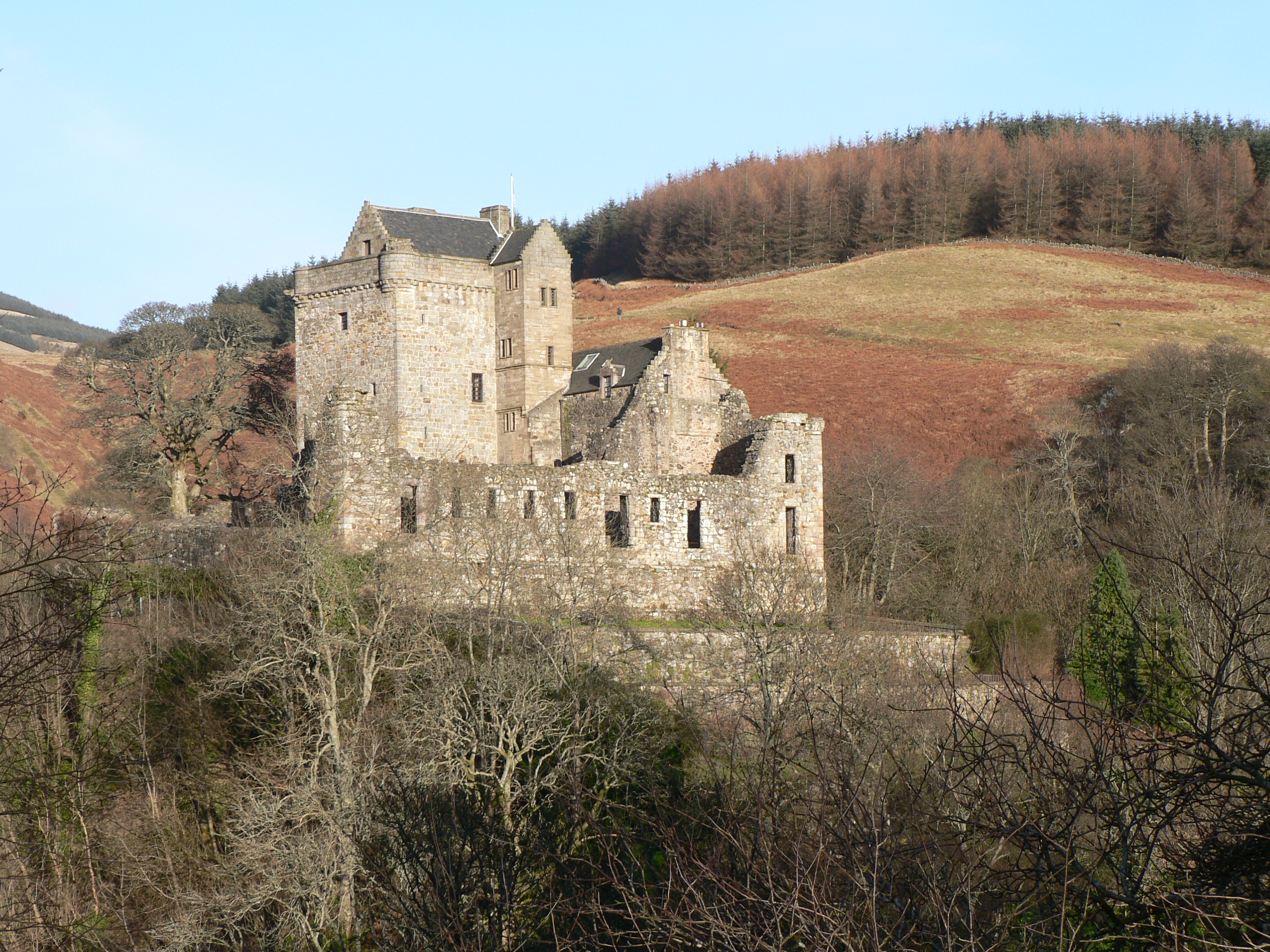
St. Monans Church
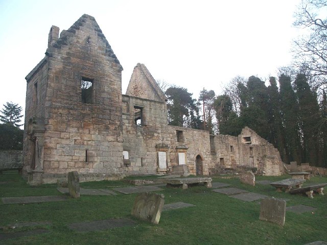
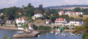
Anyway, on with the walk.  We left Elie and it's multi-coloured houses and headed out to St. Monans. Like a lot of places in the East Neuk, St. Monans tends to be overlooked in favour of the Anstruthers of the world, which is a real shame, as it's a really pretty little village.  Named after Saint Monan, who was an early Christian martyr, killed by marauding Danes during an attack on the Isle of May in the 9th century, the village got a big infusion of credibility in the early 14th century, when King David II of Scotland re-dedicated the chapel following his victory in battle, and his recovery from the wounds he suffered as a result, a recovery which he credited to the intercession of St. Monan. We walked through the graveyard of St. Monans' parish church, which in common with many little churches in the Kingdom, was very pretty, although I wasn't convinced by the graveyard finishing right on a cliff!

The number of interesting little churches we have passed on our walks has actually inspired me to undertake a little project, which I'm going to slot in during times we are not doing our 'official' walks. I plan to travel the Kingdom and see how many churches I can find, and then photograph them, with a view to making a little online collection of the Churches of Fife. I'm not of a religious persuasion, but I do like the architecture associated with churches, particularly the old ones (and St. Monans church certainly meets the criteria for being old - earliest mention of it goes back to the 14th Century), and I'm always looking for a project to keep me occupied, and this will hopefully help me not only improve my photography, but will help me find out a bit more about the history if the Kingdom.
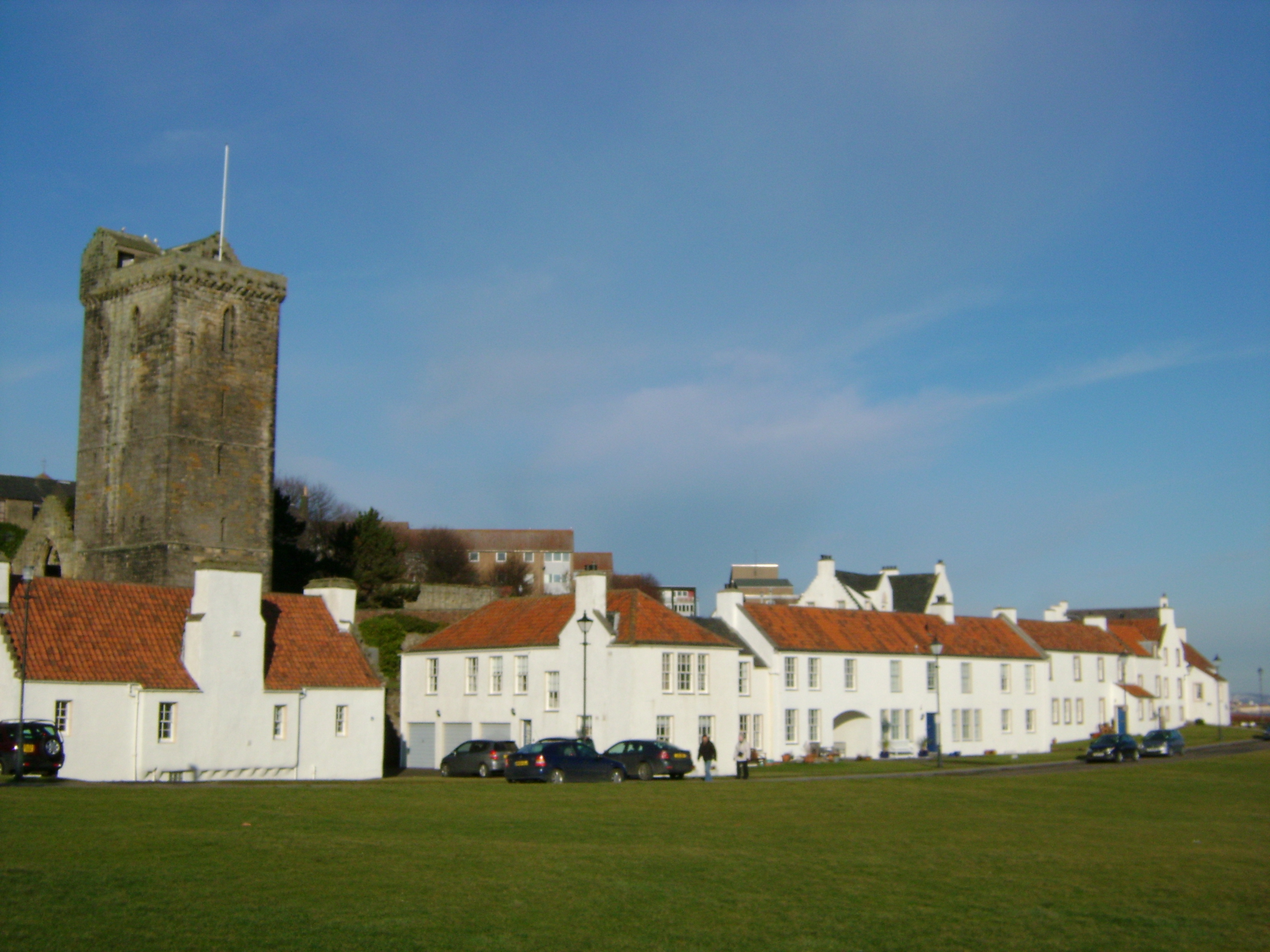
Pitenweem

But, I digress. We walked through St. Monans, which probably hasn't changed much in the last few hundred years, and then set our sights on the little fishing village of Pittenweem. Like so many places in Fife, Pittenweem takes it's name from Pictish times.  Meaning 'The Place of the Caves', the cave in question being St. Filian's. St. Filian was an Irish monk who came to Scotland in the 8th century. He is most famously known as the saint whose relic (apparently, an arm bone) was allegedly carried by King Robert the Bruce during the Battle of Bannockburn, which of course resulted in a home win for the Scots.

Pittenweem is your archetypal fishing village. The harbour is the hub of the village, with everything else radiating out from there and the fishmarket.  What a lot of people don't realise is that for a long time there was a burgeoning secondary industry along the Neuk coast - salt production. All along the Neuk coast at one time, you could see salt pans of varying sizes. In the pre-industrial age, when water quality was still generally good, they would gather in volumes of salt water from the sea and lock it into the pan (which in this instance, describes a large but shallow body of water, constrained in some way).  As the pans were shallow, the water would evaporate, leaving behind the salts.  In St. Monans you can still see a windmill which was used to grind the evaporated salts down, prior to shipment.

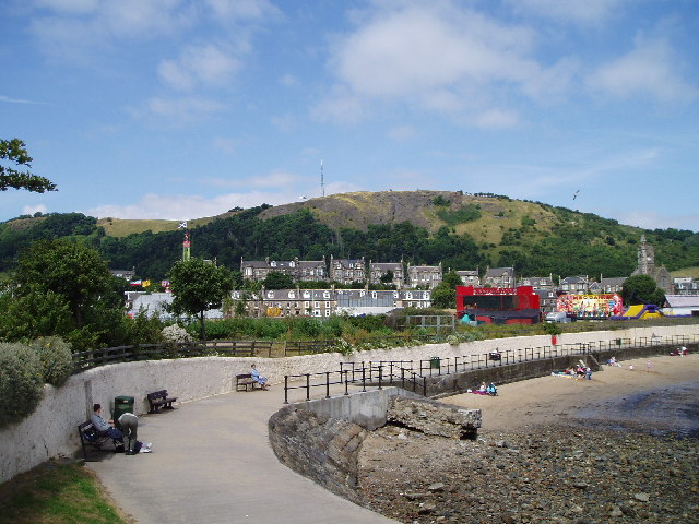
Next up was Anstruther, home of the famous Anstruther Fish Bar, and historically, the home of The Beggars Benison.

Like the rest of the little coastal villages, the shoreline of Anstruther is made up of white walled, red roofed houses, which are decidedly Dutch or Belgian influenced.  Back in 'ye olde dayes', the East Neuk was, for a time at least, a trading centre with Dutch and Belgian captains as they sailed up from England before heading back across the North Sea. These ships had red tiles as ballast, and once the locals realised that they would make an ideal roofing material, they became highly prized. This style of building can be seen all along the coast.

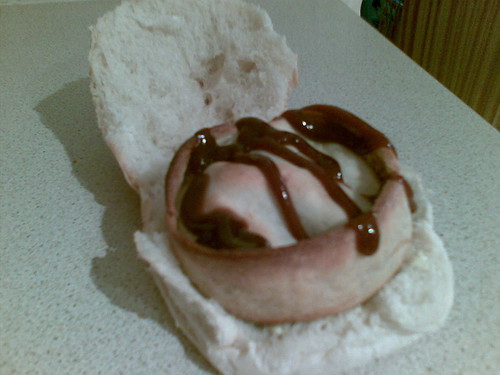
Anstruther Fish Bar. Unsurprisingly!
The Anstruther Fish Bar is possibly the most famous fish and chip shop in Scotland, regularly being named the best in the land, and featuring in the final few of the best chippy in Britain contests.  If you time it wrong, you can find yourself queuing for 40 minutes or more, but last night when we happened across it's door, there was, for the first time in my memory, no queue!  With that in mind, it would have been rude not to avail ourselves of their award winning (and, if the press clippings on the wall are to be believed, approved by Royalty, and Tom Hanks) fayre.

Anstruther is also the former home of The Beggars Benison, which I actually have already mentioned in a previous blog, but I think they merit a recap! The Benison was a 17th century gentleman's club, which was devpted to 'the convivial celebration of male sexuality', according to it's charter. Unsurprisingly, the gentlemen in question were from the upper echelon of society, and would meet to drink, dine, sing bawdy songs, indulge in bawdy toasts, and indulge in various practices, which would generally involve the club's apparently significant stock of 17th century porn, or the visual examination of a local 'Posture Girl', who was always naked,  and I would suggest it was a fair bet that the assembled gents looked with their hands as well as their eyes!  The Benison also had an initiation ritual which was described in some detail by the club's Recorder. Like most private clubs of the time, details records of ceremonies and meetings were kept, with the records from The Benison now being kept at St. Andrew's University.  The initiation ceremony involved
"[The new member was prepared] in a closet, by causing him to propel his Penis until full erection. When thus ready he was escorted with four puffs of the Breath-Horn before the Brethren or Knighthood, and was ordered by the Sovereign to place his Genitals upon the Testing Platter, which was covered with a folded white napkin. The Members and Knights two and two came round in a state of erection and touched the Novice Penis to Penis. Thereafter the special Glass, with the Society's Insignia thereon and Medal attached, was filled with Port Wine, when the new Brother's health was heartily and humorously drunk, he was told to select an amorous Passage from the Song of Solomon and to read it aloud."
I'm fairly certain you wouldn't see that down the local golf course these days!  As if there was any doubt left regarding the nature of the club, a typical extract from the club records shows:
"1737. St. Andrew's Day. 24 met, 3 tested and enrolled. All frigged. The Dr. expatiated. Two nymphs [young girls], 18 and 19, exhibited as heretofore. Rules were submitted by Mr. Lumsdaine for future adoption. Fanny Hill was read. Tempest. Broke up at 3 o'clock a.m."
Quite!

Having had our fill of fish and chips, we resumed our path, with the next stop being our target for the day - Crail.  It was around the point where we were a mile or so outside of Anstruther that the path started to lose it's path-like hue, and become dirt road and field. It was an odd part of the walk, looking to the right, you saw the coast, the sea, some really nice views, whilst casting an eye left would see it witness, of all things, a piggery. Even had your eyes not alighted upon the field of porcine delights (including dozens and dozens of piglets, which are kind of cute, I have to say, and probably very, very tasty when transformed into bacon), your nose would have alerted you of it's presence. Although we didn't know it yet, the pigs were not to be our only encounter with farm animals!

"You lookin' at me pal?"
There's really not much other than fields and shore between Anstruther and Crail, so we did what we were out to do, and walk. As we found ourselves getting closer to our target, the path narrowed, and involved a little climb to go through a gap in a fence to allow us to continue. It was here we encountered what may have been our nemesis, in a decidedly bovine shape.

Cows seem to be becoming a recurring theme for my walks, I was out last week walking around Loch Ore with my friend Carol, when we happened across a herd of escaped cows. I knew there were cows in the area, but was expecting them to be safely ensconced behind a fence. This proved not to be the case then (much to Carol's chagrin), and so was last night. We looked up and saw a not insignificant volume of cattle not only block the gap, but it looked for all the world like they had set up sentry positions to hinder any attempts at progress.  Unperturbed however, we soldiered on, resolute in our belief that, if it came to it, we should just about manage to win a battle of wits with the assembled throng of steak on the hoof. 

And so it came, that using our combined powers of logic, diversion, strategy and ability to quickly determine the weaknesses of domesticated ungulates, that we, unlike the Balrog, did indeed pass, and made our way along the increasingly precarious path to Crail.

It was at this point that the path essentially stopped being a path and became more of a muddy track, culminating in, as I have already mentioned, the quagmire that was the final section of the path taking you into Crail. It's a shame, because up until that point, it was an absolutely glorious walk. However, we made it, and got to the bus stop in time for the next bus to take us back to our starting point.  Having congratulated ourselves in our outwitting the cows, we found ourselves sharing a bus with a group of people who would struggle to outwit an amoeba, never mind a complex organism. Their main means of communication appeared to be the incoherent grunt, oft favoured by those of limited intellect, the frequency and volume of said grunts often being in direct proportion to their stupidity. Every now and again, you would make out at word which seemed to be more or less English, it was almost as if they were trying to be actual people. I guess they should be commended for the effort.  One of the group did managed to construct enough of a sentence to enable use to ascertain that he was trying to effect the transaction of some sort of substance, the measuring of which required scales, and consumption of which required 'skins', with the value of said transaction apparently varying from £50, to £70 before, it would appear, settling on £60. If anyone ever wondered why the call it dope, I would present to you, ladies and gentlemen, exhibits 1 to 4, as seen, and heard, on the bus last night.

Join us again next time out, as our intrepid explorers undertake the longest single leg of this journey of discovery - the 13 miles between Crail, and the ancient and historic university town of St. Andrews.  As scary as it is, I can't wait...

Wednesday 13 June 2012

The Magic Kingdom

Greetings once again, blog-followers.  It's been a wee while since I last updated this, sorry about that, I had stuff going on, but can now, in true soap opera style, catch up by pretending it was all a dream.  You may remember that the last part of the journey stopped at the town of Leven, which, by some divine co-incidence, was where the next leg started from!

So, as has become my wont, I shall commence with the tale of the tape, for all you budding statisticians. Sadly, at the moment, I won't be able to add in the now traditional screengrab of the app I use to record time and distance, but I will add that in at a later juncture (Edit - 15 June - as you can see, it's been added now!).  But, to the numbers...

Time: 3h 7m 17s
Distance: 9.09 miles *
Blisters: 1. It was, however an absolute swine of one, right on the area of my heel popularly known as the Achilles.  I have no idea why a blister has suddenly decided to present itself there, but it did, so I now have to be aware of that too!
State of me at the end: The closest I've ever been to just giving up the ghost and falling down into a ditch.

* - This doesn't include the distance between my house and the street where Ian picked me up and dropped me off, nor does it include the distance from the bus station in Leven to the car, so combined I think those would be worth about another mile.

This leg of the journey was the hardest one yet.  Partly because we decided to eschew the actual path in favour of the sandy beach, the traversing of which took more out of me than I initially realised, and partly because the last part of the walk included the now obligatory mountainous ascent of Olympian proportion.

I have come to the conclusion that the Kingdom of Fife truly is magical. It must have some kind of morpheous geology which seems to know when I am out on a walk, and reconfigures itself to ensure that the last part of the walk is a climb of ever increasing severity, the more tired I am, the more severe it makes the gradient.

Leven Beach
So, this leg of the trail commenced from the town of Leven, the Vegas of the North. I must admit, I will always have a bit of a soft spot for Leven, as I child I loved the place, for, every now and again, my parents would take me there for a day out.  It was far enough away from Dunfermline to be interesting, close enough for it not to be a trek.  The main factor in Leven's favour was it's shorefront, which was home to (at the time) 3 or 4 amusement arcades.  Sadly only one I think remains along the front, with another still going along by the bus station.

Leven seems to trace it's origins back to Pictish times.  In the old Pictish language 'leven' meant flood, and the local Loch Leven is a flood lake.  The modern settlement of Leven is of 16th century vintage, but it wasn't until the arrival of the train in 1854 that Leven started to make a name for itself, quickly becoming a tourist resort, most of it's travelling trade coming from the west coast during the Glasgow fair.

Leven built on this fortune by developing the aforementioned shorefront and including a links style golf course, the Leven Links (I wonder how much marketeers would charge for creating that name today!) which is used as one of the qualifying courses for The Open Golf Championship.

Selkirk's statue
As we wandered our way out of Leven, the next brush with civilisation came in the form of Lower Largo, home of the somewhat famous Alexander Selkirk.  I know what you are thinking, Alexander Who??  Well, if I was to tell you that Mr Selkirk was a sailor who wound up a castaway on an island, where he wound up meeting and befrending a native, before being rescued, would you think to yourself "hmmm, that story sounds familiar...". It should, as it was turned, by Daniel Dafoe into Robinson Crusoe.  Unsurprisingly, Selkirk is Lower Largo's only claim to fame!  It's a pretty little village though, I'll give it that!

Now that we are winding our way out along the East Neuk of Fife, the coastal path truly lives up to it's name.  There are some absolutely captivating views to be had along the way, so much so that we decided to forgo the actual path itself for a few miles, and walk long the beach pretty much from just past Largo until we neared Earlsferry.  Unfortunately, a lot of the beach was fairly soft, and after a couple of miles, it was starting to take a bit of a toll.  Sadly, being a gentleman of rotund stature, I have a fair amount of mass with which to impress the sands, making the beachfront going, at least for me, somewhat heavy. However, if nothing else, it made sure that I had to work hard for my money, to paraphrase the late Donna Summer.   As an aside, am I the only person who sees a certain irony in Robin Gibb shedding his mortal coil not too long after an advert started playing on the TV promoting the Bee Gees' 'Staying Alive' as the ideal tempo to employ when administering hands only CPR...

The end point of the jaunt was Elie and Earlsferry.  Once two separate villages, Elie and Earlsferry were formally merged in 1930. Earlsferry it is said, is where MacDuff, Earl of Fife crossed the Forth whilst fleeing from King MacBeth, who I think someone once wrote a play about... Elie and Earlsferry are both staggeringly pretty.  Rows of painted houses, some amazing shoreline scenery, I would say it's probably my favourite part of the East Neuk.  It also has an automated lighthouse and the ruins of a tower, both of which are cracking locations for photoshoots, and both have been utilised by me in the past.  I can thoroughly recommend them!

Earlsferry
The only down side about Elie and Earlsferry is the amount of effort it takes to get to them from the coastal path! To get there you first have to climb a coastal hill, steep, slippy and, one feels, constantly ready to slip something under your feet to cause havoc with your extremities! Strangely, getting up the one side is only half the battle.  Once you have crested the hill, you then go down the other side, for a spell.  It's a testimony to how brutal this hill is that even the downhill sections are uphill!! Once you have finally reached the end of the mountaineering section, you are still caught in an uphill nightmare as you cross the golf course, before finally finding tarmac on the way through the Earlsferry part, on your way to the Elie part.  As you have probably guessed, this is all, also, uphill. By the time we had reached the terminus of our jaunt, I was giving serious contemplation to the immediate amputation of my feet to spare me from ever having to do that again.

The worst over, or so I thought, we boarded the bus to take us back to Leven, where we had left Ian's car.  It wasn't a long trip, but it transpired it was long enough to ensure that when I tried to move again to egress from the charabanc, I'd already started to seize up, adding weight (if you pardon the pun) to my desire that exertion of this magnitude is never repeated! That said, despite the abject misery if found myself in, and despite the pain I felt, the next day, when I reflected back upon the trek, I actually felt a little bit proud, mostly because I made the trip, hills and all, without stopping for a breather, the first time I have managed that. I guess I am slowly getting a little fitter!

I was encouraged to send a link to my blog to the people who are responsible for the Coastal Path, and I got a very nice email back from them, telling me they enjoyed the reading thereof, and giving me a bit of information about why the path takes the rout it does in some areas, which was very interesting reading.  I want to take the chance to say to these guys, thank you.  Thank you for all the work you do in promoting, maintaining and developing the Coastal Path.  I think this is a real jewel in Fife's crown, and I don't for a second doubt the amount of hard work it's taken to get the path to the consistent quality it is.  If I am critical of the path, it's generally very minor in nature, and is, really, a testament to the fact that 99% of the path is exemplary, to the point where anything less than that is noticeable, but only when compared to the high standard that the path generally maintains.

The next leg of the journey will see us hit Anstruther, a part of the journey I've really been looking forward to. Not just because of the world famous Anstruther Fish Bar, but because it will give me a chance to relate one of my favourite snippets of historical information pertaining to the Kingdom.  The tale of The Beggar's Benison.  Stay tuned, you really won't want to miss this one!

Thursday 31 May 2012

And now a word from our sponsors...

Well, almost!  During our last walk, the mini marathon, Ian asked if I'd like him to write a blog entry, giving an outside view of how my walking skills ad indeed, my fitness is progressing. I thought it was a great idea, it's interesting reason for me as much as anything else. So, true to his word, Ian put some words down.  What Ian wrote is below, unedited, unabridged - my theory is if Ian felt the words were fitting, who am I to argue! There are some start home truths, but nothing I didn't already know!!

Anyway, from the very close outside, here's Ian's take on things...


As an avid reader of Stuart’s blog and his companion on our trek along the Fife Coastal Path, I thought it might be an idea to offer my own thoughts as to how the big man’s doing..
I’ve been pals with Stuart since our early secondary school years. That’s coming on for 28 years now. Longer than we’d both like to admit.
As a youngster, I cannot remember Stuart being fat in any way. I guess he was quite stocky but perfectly normal for his age and height. As we got older, he did get bigger but not worryingly so. After Stuart got married, we lost touch for a while and we only caught up very infrequently. When I did see him, I was shocked at how the weight had piled on, both in respect of him and his wife. The reality was that the pair of them grew to exist pretty much solely on takeaways and other convenience food. Sadly, Stuart’s marriage didn’t work out. His weight problem remains a legacy of those unhappy years.
Stuart has not had his problems to seek in his life. However, the single biggest thing he can do to improve his lot, his job prospects, his chances of finding love, is to lose weight and lose it for good.
There is no magic cure for obesity. No quick fix. Despite all the science, the theories, the fad diets, the solution is quite simple. To lose weight you must burn off more than you put in. To Stuart’s credit, he totally recognises this and he’s resolved to doing this the old fashioned way.
Stuart has referred to our journey along the Fife Coastal Path as his “Long Road To Freedom”. That’s a very romantic way of describing our efforts but I think it’s entirely appropriate. With every laboured step we make on our walk, he’s changing his life for the better. Plus we’re learning more about the County that we’ve lived in all our lives but have never properly explored.
Lesley-Anne and I are both really impressed with Stuart’s stoicism. The poor guy is really suffering with every footstep. Blisters, Back Pain, strain on his joints, sunburn, almost breaking both his ankles, he’s enduring the lot. However, other than the occasional blood-curdling scream of agony (as when he fell down the steps yesterday at Dysart) he never complains. The man’s got bottle and you can tell he’s committed. He tells me he eagerly looks forward to going on the walk and after it’s done he feels a glowing sense of satisfaction. It’s just what goes on inbetween that’s painful. So it is for all meaningful exercise.
We’re currently walking at a pace of about 3 mph, which is little more than a dawdle for me. However, it’s easy to forget Stuart has to expend a great deal more energy with every footstep of progress than we do. To get an idea of what he’s experiencing, I would really have to strap a weight equivalent to my 10 year old son to my stomach before we set off on each trip! The good thing is that he is getting instant results. He might not realise it yet but I can actually see evidence of his progress. He is getting fitter and stronger with each walk and the weight is coming off in a consistent and sustainable rate.
Stuart is in no shape to do anything more strenuous than walking at the moment, although as I know he loves his racquet sports, we’ve tentatively introduced the odd game of squash . As the weeks go on and the weight hopefully drops off, I’m going to get him doing some interval training and also do some hill-walking. Then he’ll know the true meaning of pain!
Stuart has 6 months until he is 40. We’ve set a target of a 5 stone weight loss. It may be slightly unrealistic to expect him to reach that weight before his birthday but it would be great if we could set him well on his way. The first stone will be a great landmark for him. Hopefully we can reach that in the next couple of weeks. Lesley-Anne and I are delighted to combine our love of walking with helping Stuart on his own journey but we can’t be with him all the time. His battle will be won or lost in the evenings when he comes in from work. If he can find more productive and active things to do in his down time and resist the temptation to plank himself down in front of the box and snack, then ultimately he’ll get to where he wants to be.
There's nothing there I can argue with. Id like to be able to argue with some of it, particularly my age, but no matter how much I try and ignore it, it's not going away!  It's a hackneyed cliche, but any journey is a series of steps. It is as literally true for this journey as it is metaphorically. I think one of the key points Ian raised is the last one - I need to get myself out of the habit of vegging out on the sofa with the cat and a chocolate bar and packet of crisps. That's going to be a hard change, but I've (mostly) managed it for the past couple of weeks, and I've totally managed it this week.  There was a temptation to 'reward' myself with a Twix after the walk, but as I thought about it, how much if a reward would it actually be. Surely, a reward is something positive, whilst, for me at this point in life, at least, a Twix would not be a positive thing. Tasty, certainly, but absolutely contrary to my aims. So, there are changes being made, and changes more to come. They won't be easy, but would be so much harder were I completely on my own.  I've said it before, but the support of Ian and Lesley-Anne is priceless.  As is the support and encouragement from all my friends. The best way I can think of thanking you is to use your support as further motivation, taking your positive words as strength when I need it.

I love you guys!

Tuesday 29 May 2012

No pain, no gain...

Today saw me undertake the biggest walk I can remember doing.  Myself, along with Ian and Lesley-Ann departed from Kirkcaldy, and arrived, some 3+ hours later in not so sunny Leven, having traversed our way through the various Wemyss, Buckhaven, the Vegas of the North that is Methil, before we ended up in Leven, where we added a final dash to allow me to go and pick up my car, which was being MOTd today. It passed, with a minimum of fiscal pain!

I know that you love yourselves some stats to help you mentally plot our course, so the facts and figures for today's jaunt are...

Read it and weep...
I almost did!
Distance: 10.8 miles (yep, you read it right folks, double figures!)
Time: 3h 47m 00s
Average Velocity: 2.8mph
Calories Burned: 1021
Broken Bones: 0. Although it was a close run thing...

So, we started the mini marathon in Kirkcaldy, parking Ian's car at the car park in Ravenscraig park, which, if I remember rightly, got a mention in a Scotsman report some years ago as being a notorious meeting point for people who are of a persuasion for using car parks for clandestine fornication.  There was none of that going on today, as we started on our journey through the park, making our first slightly wrong turning within 10 minutes. It was in many ways, an ideal day for a long walk, the burning sun, which so afflicted me on Sunday's sojourn was obscured by cloud, there was a mild threat of rain in the air, which fortunately, never was manifest into actual precipitation, and the breeze was firm enough to be noticed, weak enough not to be actually cold.

Pan 'Ha, Dysart
Finding ourselves on the road, we carried on regardless and meandered our way down to Dysart. Like many parts of Fife, Dysart has something of a Janus-like quality to it.  Along the sea front, where we were, it's spectacularly pretty, with a row of whitewashed houses, all immaculately maintained. Head even slightly inland, however, and it's a different story, with scatter flats, other forms of social housing (which I'm not trying to disparage, they serve an important function in society), and a generally run-down look and feel. Dysart itself is one of the oldest communities in Fife, with links going back to St Serf in the 6th century, making it even older than my ex wife. One of the theories behind the name itself, is that it is from the root "Deserta", meaning 'fasting place of the  holy man', the holy man of course, being the aforementioned St Serf. There is a later link between Dysart and the St Clair (or Sinclair) family. Some of you may be looking and thinking "why do I know that name?". Well, the St Clairs are more famous for being the familty who commissioned and financed the construction of what is arguably one of the most famous churches in the land - Rosslyn Chapel, which has sizeable links to the Knights Templar.

So, we navigated Dysart with a minimum of fuss, and started the climb which would take us from the old harbour village, to the next piece of civilisation on our map, West Weymss. To get there, we had to climb up, and then back down, some steps, which weren't exactly pristine, but more than easily navigable. Imagine my surprise then, when I became all too aware that my ankle wasn't at the angle I was anticipating, rather, it had decided to rotate through 90 degrees, so the sole of my foot was perpendicular to the step in question. Feel free to continue imagining my consternation as I put my not insignificant weight on said ankle, heard a most ominous cracking noise, and then was the unhappy recipient of what could only be described as a lancing firey pain which had my ankle as it's source. I am sure I will be forgiven for the bull-roar I let out as I crumpled to the ground.  Ian, who was behind me and had an even better view of the unnatural angle my ankle had adopted was sure, as at that point was I, that it was going to be something terminal, that my ankle had been rent asunder, and that the emergency services would be needed.  As I sat there holding my leg in the air, pulses of pain providing a reminder, not that one was needed, that ankles aren't really designed for that kind of manipulation, I shared his fear. For the first few precious seconds I was too sore and, being honest, a little scared to even try and move my foot. 30 seconds later I manned up and made a tentative attempt to manipulate my throbbing extremity. To my immense relief, my foot moved as nature intended., so, fuelled by adrenalin and stupidity I stood up and tried putting some weight on my ankle.  It held up, thankfully, so I made the decision to continue on to West Wemyss and then see how it held up.  Given that I've already mentioned that we finished in Leven, I guess I've spoiled the cliffhanger in regards my ankle!  Needless to say, I managed to continue the walk (despite rolling over my other ankle in Buckhaven - yeah, I know, a guy my age should be able to, you know, walk, by now). I am starting to think it may not have been the best idea, following my now traditional bath and the prior removal of all my socks, my ankle has taken in a decidedly swollen appearance, and, to coin a phrase, hurts like a mofo. Still, I'll live!

So, assuming anyone is still reading and hasn't been put off my my boring you with ankle related woes, West Wemyss. One of the 3 Wemysses (alongside Coaltown of Wemyss and East Weymss - more about that later), West Weymss (or WW as I will call it from  now) is often overlooked, mostly because it doesn't have the benefit of the main road passing through it.  To get there you have to really have a reason, turn off the road and then meander down the hill. It's a shame, because again, it's a pretty enough little place, well, it is at the waterfront anyway. It is also where we saw one of the most bizarre things I've seen for a while, and one I really wish I'd taken a picture of.  Imagine, if you can, a caravan.  Go that? Cool.  Now, imagine if you can, a garden shed, but one that is bigger than the caravan.  Still with me? Excellent.  Now, build the shed around the caravan, leaving only a couple of windows, and a door, which is placed to match the location of the caravan door. That is what we happened across. It takes all sorts I suppose.

Loch Leven Castle
The 3 Wemyss all take their name from the noble Wemyss family, most notably Sir John Wemyss, who was the patron of Wemyss Castle. The castle itself was destined to have an unexpected, but lasting impact on Scottish history, being the place where Mary, Queen of Scots met her future husband, Lord Darnley. It was destined to be a tumultuous marriage.  Neither party was destined to be entirely faithful, but Darnley had a vicious and jealous streak, and decided to banish one of the queen's most trusted advisers, on the grounds that he believed they were having an affair. Shortly after, he turned up dead. After it was established that is cause of death was strangulation, suspicion fell upon the queen and her close entourage, particularly Earl Bothwell. Suspicions only grew when Bothwell married the Queen shortly thereafter.  Mary's grip on the throne was always fairly tenuous, and there was an uprising which ended with a loss for the queen, who found herself imprisoned in Loch Leven Castle, ultimately of course, she was to end her days upon the executioner's block.

Next up was East Weymss, and it's famous caves.  As with it's western namesake EW has some fascinating history, going back to Pictish times, and beyond.  It's most famous for it's series of natural caves which span the seafront.  Sadly, they are all in a fairly poor state, but if you know where to look, there is plenty of evidence of their ancient use.  The main cave, which is a little bit of a walk in, is known for it's cave art, carved into the walls in ancient times.  It's also know for a more recent occupation (I say recent, it's all relative!).  In the mid 18th century, the main cave was home to a nailmaker called Jonathon (indeed, it's now known as Jonothan's cave) who had been forced into penury following the opening of a metalworks nearby.

A Buckhaven Big Mac
As we continued along the path, our next brush with civilisation was with Buckhaven.  The town owes it's origin to hordes of invading Norsemen (which the locals, it would appear, try to emulate on a Saturday night).  At the start of the 19th century, Buckhaven was home to the second largest fishing fleet in Scotland.  It's been pretty much all downhill since then. At one point, Buckhaven, Methil and Leven were distinct towns, now they are, to all intents and purposes, contiguous.  These days Buckhaven is best known for having an entrant on reality tv 'singing' show, The X Factor, and being the inspiration for the "Buckhaven Big-Mac", which is a scotch pie on a roll.

Whilst Buckhaven might not win any 'Jewel of Scotland' awards, I would hazard a guess that it would beat it's next door neigbour, Methil. I'm trying to think of something positive to say about Methil, I really am.  It has a road which leads you back out, I guess that's a positive.  As we were traversing the mean streets of the town, there was a gaggle of neds coming the other way, armed with babies and tattoos (sometimes the babies had the tattoos), very dubious hairstyles (and that was just the men), showing themselves to be unaquainted with the concept of work, or indeed teeth, they offered a visual representation of the malaise which so afflicts towns like Methil.  Methil used to be a hard working town, shipyards, oil platform construction, there was a lot of heavy industry there, but when it moved out, nothing moved in to take it's place.  Methil is where hope goes to die. It's so bad, it got a line of it's own in The Proclaimers' song 'Letter from America'.

Fortunately, it wasn't long before we trudged our way out of Methil and into Leven.  Following a quick pit-stop for Lesley-Ann, we made it to the car park which was our allotted stopping point, rested our weaky bones for a brief spell, then wandered our way through the town to collect my wheels. By the time we got to the mechanic, I was pretty close to just shutting down.  Fortunately though, I made it, and after a stop for coffee at the Wellsgreen driving range (which was very nice, and the lovely girl who was in charge of the coffees gave us each two of those funky little caramelised biscuit type things, so she's a superhero in my books), and a little detour to Glenrothes, I eventually made it home.

We pick up the trail, and the story, next Wednesday.  Stay tuned as our heroes leave Leven (which I will go into on the next blog - this one is long enough as it is!) and start working our way round deepest, darkest Fife - the East Neuk!

Sunday 27 May 2012

Burn, Baby, Burn...

So, the great cross-Fife trek continued today, as I broke the habits of a lifetime, and actually got up early on a Sunday in order to go for a walk!  This one was a bit different, in that I was doing this one solo. Both my walking buddies were working, so challenged me to complete the next leg on my own, one which I'd already done, albeit in the other direction!  So, today's trail took me from Burntisland train station, all the way to Kirkcaldy.

I know how much some of you are stats fans, so the once the numbers have been crunched, they come out reading:

Today's route
Distance: 6.61 miles
Time: 2h 17m 28s
Average velocity (because that sounds so much faster than speed): 2.8mph
Pain at end: Well, the back of my legs and neck are sunburned, my left ankle seems to fatigue relatively quickly, but generally, not bad. I put that down to two things - 1) apart from a bit at Kinghorn, and then a few major ups-and-downs as I approached Kirkcaldy, it was relatively flat, or at least, the inclines were long but shallow, for the most part, and 2) my new secret weapon - memory foam insoles for my shoes. They made a huge, huge difference.

You may have noticed a map has appeared, as if my magic! The reason is that I actually remembered to bring my phone's USB cable home with me this weekend, so I can plug the phone into the PC and upload images!  The image has been screencapped from my JogTracker app, which has been very handy in helping me pace the walks. My average velocity on this one has dropped from the last couple, again, it was the last 1.5 miles or so which killed it, I was bubbling around the 3mph mark for most of it until then. Not having my pacemakers this time didn't help either! In plus news though, I only stopped once, for about 3 minutes in Kinghorn to buy some water. The stop would have been much shorter, but the young lady who served me seemed to spend a lot of time confused when trying to work out how much change to give me from the £1.10 I handed over for a bottle of water which cost £1.05 (which, as an aside, is a rip off!). Anyway...
Burntisland Train Station

So, the walk itself. I started off at Burntisland train station, as the Burnt Island was the end point of the previous leg. When I left Kirkcaldy, the sun was shining, the birds were tweeting (quite an achievement, it can't be hard using a phone or computer with those small feet and beaks) and it promised to be a glorious day.  When I got to Burntisland it was shrouded in a sea mist, and actually fairly cold. By the time I had walked up from the station to the beach, however, it was already starting to lift, but that haar would follow me all the way to Kirkcaldy!  I spoke about Burntisland in my last blog, but gave it a bit of a short shrift, and it deserves a bit more. It's very much a town of two halves - heading out from the town toward Kinghorn, there are some spectacular buildings, including my favourite, which is right on the beach. It used to be a pavilion by the looks of it, and the faded advert for ice cream still on the roof, but has been converted into a house. I was going to try and grab a picture of it on the way past, but there was someone standing at the window looking out, he may have been a bit odd if some random stranger started photographing his house!

Burntisland has much more history than a lot of people, including I am sure, many who live there, give it credit for.  There are rock carvings in a hill just on the edge of the town which are thought to be up to 4,000 years old, and the area has a Roman connection! The general charged with the invasion of Britain, Gnaeus Julius Agricola is thought to have camped in the area during the invasion of Caledonia, circa AD81.  The entity known as Burntisland, however, can be traced back to the 12th century, when the harbour and surrounding land was owned by monks from Dunfermline Abbey, and at the time was known as Wester Kinghorn. This all changed in the 16th century when the monks sold what became Burntisland to King James V, who granted the land Royal burgh status.  The name is thought to come from the burning of fishermens huts on an islet which is now part of the harbour system. 


One of the enjoyments I've been getting from my walks, has been the opportunity to learn so much more about the Kingdom, the land of my birth, and where I've lived all my life.  I've been constantly amazed at how much I have learned as a result, firstly by noting things I see on my walks, and then doing a bit of research for this blog.  It's not why I'm doing the walks, the real reason behind them is as part of my new fitness programme, but I'm really glad I am being given the opportunity to learn more.


After Burntisland, comes Kinghorn.  If anyone from the coastal path trust happens to read this, if I could make one suggestion for any part of my walk so far, it would be a) signpost the path better in Kinghorn, and b) build an actual coastal path to cover the distance between the two. The views across the river in that area are stunning, especially on nice days, but they are lost as you have to follow the road, rather than the coast. The road itself is, well, roadie! It's a constant uphill section for about a mile or so, but the gradient isn't too bad, you feel yourself having to do a bit more work to get up there, but it's not a lung-buster. That came later!! 


Getting into Kinghorn itself, you need eagle eyes to spot the tiny marker for the coastal path, which then takes you downhill, toward the harbour.  The altitude you gained in the preceding mile is lost in the space of 100 yards.  Kinghorn has a penchant for interesting street names. For example, when you turn off from the main road to start the downhill section back to the coast, you are doing it down David the First Street. If that doesn't take your fancy, how about Alexander the Third street? A lot of Kingorn's streets have a decidedly regal theme!


Kinghorn today is known as a holiday centre, thanks to Pettycur Bay Caravan park, which I've only ever been in twice - once in a professional capacity when I was the commercial manager for Fife Flyers and 'The Bay' was one of our sponsors, and last hogmanay in a social capacity, seeing in the new year with some friends. Apparently, the lifeboat station at Kinghorn is one of the busiest in Scotland, something which surprised me! Whether that's got anything to do with the 'Black Rock 5' race, is unknown! The BR5 is a race held every year which has, as it's course, a road, the beach, and the black rocks, which are about 1 mile offshore, and are only visible at low tide.  The race, held once a year, is timed to co-incide with a low tide, but even so, the water you have to run through to reach, and then run around, the black rocks, is usually about knee deep.


Kirkcaldy was next in line - the place I've lived for that past several years, and home to the father of modern economics, Adam Smith, constituency of former Prime Minister Gordon Brown, and famous for linoleum production, "dancing on the streets of Raith" and of course, Fife Flyers.  The path going into Kirkcaldy was very foggy as I traversed it, and was given a decidedly spooky quality thanks to the herds of seals which were basking on the exposed rocks (it was low tide), who were barking and howling. I have only recently read Samuel Taylor Coleridge's 'Rime of the Ancient Mariner', and I must admit, the strange noises, and foggy vista made me think! 


There is much more which can be said about Kirkcaldy, and this part of my walk (including my getting a little lost!). However, that, my friends, will be for the next instalment!


As I said at the beginning, the walk today was different, being that I was on my own. I'm not entirely sure I enjoyed it as much without someone to talk to, and someone to drive on the pace. I suffer terribly when I am being pushed hard, but I know that if I'm not pushed hard, I won't get the results. I am not, sadly, one of those people for whom weight just falls off. I just need to look at a pie and I put on 3 pounds. I must also admit, it was with a sense of vague disbelief that I actually voluntarily chose to complete the walk I had been assigned by Ian and Lesley-Ann.  I've been suffering a bit from ankle pain, and could possibly have used that as an excuse. I could also have jumped off the train at Kinghorn and just taken it from there, but that, my friends, would have been disrespectful, not only to Ian and Lesley-Ann, who have been tremendous in helping me, but also all of you who have been giving me encouragement and support.  So, despite it being hard, I am glad that I did it. If someone had said to me 6-7 weeks ago, that in less than a couple of month's time, I would have walked the 30/31 miles from Kincardine to Kirkcaldy, and that I'd be able to cover 6/7 miles in less than a day, I wouldn't have believed you.  I'm always being told that I am too hard on myself, that I'm my own worst enemy.  Maybe that's true, but I hope you will forgive me if I give myself a metaphoric pat on the back.  I chose to walk the path today. I chose to cover the full distance. This time a couple of months back, I would not.  So, know what, I actually feel a little proud of myself.  I still have a long, long way to go, and it's not going to get any easier, but today, for the first time in a long time, I have a sense of... I'm not actually sure what it is really, hope maybe, that I am going to face the challenges to come, and I am going to beat them.


Wednesday 23 May 2012

The Road to Hell...

In true TV drama style, let's start with a catch-up of the previous episodes.  Thus far, we have seen our heroes, Ian and I, tackle crime on our way through the Fife Coastal Path, occasionally aided and abetted by our crime fighting sidekick, Lesley-Ann (Ian's other half).  By crime, I do of course mean, blubber.  Our last episode ended on a knife-edge as we made it back to Dalgety Bay, which, by no coincidence at all, was our starting point for the first leg of the next section of the walk.

So, what's the tale of the tape for this round then.  Well, stats fans, it is:

Distance: 7.93 miles (a new record!)
Time: 2hr 35min 13sec
Blisters: None, although it was a close run thing. I've said it before, but Compeed is a lifesaver
Parts of me in pain: Lower back (really sore), left ankle (****ing sore)
Average Speed: 3mph
Walking Style the Following Day: Drunken village idiot

I was actually quite disappointed with the final speed, for large chunks of the walk we were well over 3.1mph, but, sadly, the last mile was, for me anyway, a killer. I hit the walking equivalent of the wall. If runners hit the wall, I guess walkers hit the plasterboard partition? Not quite as strong as a wall, but still notable! However, I was determined that I wasn't going to dip under the 3pmh mark, so from somewhere found a second, third and then fourth wind. Today, however, I am struggling to find a first wind!

I covered the history of Dalgety Bay in my last blog, so will refrain from going into much more detail about the village itself.  Walking on our way back out of the Bay, we passed some monumentally expensive houses, some incredibly expensive cars, and the famous 'Glowing Beach of Doom'. It is a bit disconcerting to be walking literally inches from a beach which is fenced off with signs saying, amongst much else, "Radioactive Contamination".  It's strange to think that at one time, radioactivity was believed to be good for you, with some everyday items being dosed up with good old atomic energy, radium (the same element which has condemned the beach here) in toothpaste being the most obvious one to spring to mind.

St Bridget's Kirk. St Bridget not pictured.
It was on the way out of Dalgety Bay that we wandered past something I've been hunting for, quite literally, years - an abandoned church.  Those of you who know me will know that my principle hobby, and occasional source of alternate revenue, is photography. I've had various ideas for vaguely gothic dystopian photoshoots, set in the ruins of a church, but had not found a suitable location. Well, that all changed last night with the discovery of St Bridget's Kirk.  I actually feel a bit embarrassed at not knowing there was such a landmark on my doorstep, so to speak, given that the church has been there, in one form or another, since it was founded in 1178 by no less an authority than Pope Alexander III. The church eventually came under the authority of Incholm Abbey, which itself, perched as it is on the island of Inchcolm, dates back to some time between 1107 and 1124. It's actually quite humbling to realise that you are wandering around ruins of a structure which has, in part at least, been there for almost a millennium. It makes me feel almost bad that I want to use it as a backdrop for a scantily clad model in various poses! The key word there being almost!

So, what of St Bridget herself. Who was she? Well, I must admit my ignorance of Saints is of a depressingly large magnitude, so, being the geek that I am, I'm rather pleased to have an excuse to do some research!  St Bridget, or Bridget of Ireland (not to be confused with the later Bridget of Sweden!) is, it transpires, one of the patron saints of Ireland, along with the much more famous Patrick, and less famous Columba. She is the patron saint of... well, tons of things, such as babies, blacksmiths, children whose parents are not married (honestly!), dairy workers, fugitives, mariners, milkmaids, nuns, poets, poultry farmers, sailors and watermen!  She was considered to be one of the bridging (probably no pun intended!) figures between early Christianity and paganism in Ireland. It's no accident that her feast day is February 1st, which is one of the famous quarter days in paganism.  Unsurprisingly, there is little of her life which can now be verified, given her lifespan was between the late 5th and early 6th centuries. She was, according to the recounts which still exist, a healer, miracle worker and daughter of two slaves, who was found to be holy from the start.  As she reached adulthood, she devoted herself to religious life and was instrumental in creating nunneries, monasteries, and, somewhat surprisingly, a school of art. Not bad at all, certainly a noble figure to have a small local church named in her honour!

Once we got out of Dalgety Bay, the next stop was the little coastal village of Aberdour, which contained the first major climb of the trek (when I say 'major', I mean major for me - for normal people, probably not so much!). I've lost count of the number of times I've driven through Aberdour, I've visited the famously old church (of which more shortly), I've even played golf on the course there, but I've never really taken the time to learn anything about it, which is a shame, because it's a really nice little place. It's origins are somewhat shady, coming as they do, from the Dark Ages. The name itself is of Pictish origin, meaning "where the waters meet". It has a picturesque harbour, and what is widely regarded as one of the finest beaches in Fife, if not Scotland.  It's also famous for its old church, as I mentioned, and Aberdour Castle.

Aberdour Harbour
The castle dates from around 1200, making it one of the oldest still standing castles in Scotland, currently under the stewardship of Historic Scotland, it has all the classic castley features - towers, stately home parts, landscaped gardens and a view of the sea.  Well worth a visit if you are ever in the area, as is the 12th century St Fillan's Church, which not only is still standing, but is still in use as a working church, one of the oldest in the country still being used for the purpose it was built for. It's not the biggest church in the world, but there is an aura about the place which just entrances you.  Honestly, if you are in the area, pay it a visit, there aren't too many places you can wander into and let your imagination wander, trying to visualise 900 years worth of congregations.  It's pretty awesome.

Part of the walk through Aberdour involved the biggest climb of the day, up steps which were cut into the hillside to take us from the harbour, over the land to the beach.  I'm not going to lie, by the time I got to the top, I was panting like a grandad at a strip club.  I was, however, forced to put a brave face on it, at least for a while, as no sooner had I crested the hill, than two rather fetching young ladies came the other way, and, in the manner of men everywhere, I forced myself to suck in my gut (as much as is possible with the leviathan retundity (probably not a real word) of my belly!) throw back the shoulders and, to paraphrase those of a 'rap' persuasion, get my swagger on. Ian commented at the time that I appeared to have grown 5 inches in stature, leading me to worry that the zip of my trousers was down, but apparently he did just mean my posture.

I do tend to walk with a bit of a hunch, something I am trying very hard to train out of myself, to the point that by the end of the walk, my neck, being unused to having to support my head for such extended periods, was killing me.  Unfortunately (or fortunately, depending on the point of view), the stunningly good weather had lead to a veritable bevvy of ladies deciding to take the air of the evening.  It was a sign of how tired I was by the time we eventually hit Burntisland that I was more or less unable to continue adopting my manly pose as they passed.

The scenic bit of Buntisland
So, Burntisland then, what can be said about that. Locally, Burntisland is famous for two things - the annual shows (a travelling carnival, for my American friends) and it's associated Highland Games.  Previously, the 3rd thing the town was known for, was it's bauxite processing plant, which stained pretty much everything within a mile of it a strange orange colour. There was also a proud history of shipbuilding in the town from the early 20th century, right up until the late 60s.  I actually used to work at the docks where the shipbuilders used to be, during my spell in the oil industry, by that time, the shipyard had been converted to a fabrication yard for sections of oil rigs.

By the time I made it back to the car park, I was so relieved the torture was over, I broke into an uncharacteristic run! The walk itself nearly didn't happen, due to the fact I am, from time to time, a fool. Packing the car in the morning before I headed to work, I was quite proud of myself that I had remembered my socks. This pride quickly evaporated when I realised that I had forgotten to pack a change of trousers. Lesley-Ann was of the opinion that, in the manner of gym at school, if I had forgotten my kit, I was to do it in my pants. That was never going to be plan B, I wasn't even wearing boxers, but I had decided on a pair of briefs (I'm not a fan of briefs, but having accidentally bought them, I, in the manner of true Scots, determined that I was going to get my money's worth out of them). So, before we even started, a quick detour to Tesco was needed, for the procurement of suitable walking pantaloons.  So, all's well that ends well!

The walk was also notable for the sheer volume of air traffic we noticed.  There is a flightpath which overflies the Kingdom, but it's not one which is normally used much, however, last night there was a veritable flock of planes both lining up for landing, and on their take off climb. The geek part of me couldn't but help and identify the aircraft circling overhead, mostly Boeing 757s and Airbus A320s, with the occasional Embraer RJ-145.  If nothing else, it helped confirm to Ian and Lesley-Ann that I have been single for far too long!

So, dear readers, there ends the latest enthralling installment of my walk related Blog.  Join me again next week when we depart from Burntisland and wind up... well, somewhere.


Tuesday 15 May 2012

The Long Walk to Freedom... (from being a fat bas...)

To quote the great Winston Churchill, "this is not the end. This is not even the beginning of the end. It is, perhaps, the end of the beginning". That's kind of how I feel with the completion of tonight's walk, which took us from picturesque North Queensferry, through the industrial drudgery of Inverkeithing, before we ended our trip back at Ian's house in Dalgety Bay.

So, stats fans, what does the tale of the tape tell us tonight.  Well:

Distance: 5.71 miles
Time: 1hr 49min 15sec
Blisters: None! Thanks mainly to Ian providing emergency sockage, and the liberal application of Compeed* plasters to my feet.
Average Speed: 3.1mph

The eagle eyes amongst you will have noted that average speed is a new stat I've thrown in. Yep, it is, because tonight was the first time my average finished above 3mph, so it is, for me anyway, a bit of a breakthrough. Those amongst you who are more experienced in excursions of a perambulatory nature may scoff at my mere 3mph, but for me it's an achievement. The first of our walks was a fairly similar distance, but of much longer duration. It was absolute hell. So was tonight, but for a different reason. I'm pushing myself a bit harder, I only had to stop 2 or 3 times tonight, so if only my back didn't scream in agony for the first 4 miles or so, I'd be set!

So, tonight's starting point was our ending point last week, the historic and pretty village of North Queensferry, in the shadow of the two bridges. The Queen in question, was Queen (and later, Saint) Margaret of Scotland, wife of Malcolm III. Cars having not been invented in the 11th century (and there not being a bridge anyway!) St Margaret took to using a ferry for carriage from the capital (in those days, Dunfermline) to Edinburgh, which became known as the Queen's Ferry.

St Margaret, born in Hungary of all places, was the sister of a little known English king, Edgar Aetheling, whose family fled to Scotland following the Norman Conquest of 1066, which ended an away win for the Normans. She was, by all accounts, a truly pious person, befitting not only her status as Queen, but as the mother of three more Scottish Kings, known for her acts of charity, she ensured, for example, that any orphans or poor of the land who were around were fed before she would eat, and she would personally wash the feet of the poor. She was regarded as the epitome of a fair and just monarch, and was widely revered.  She died on November 16th, 1093, two days after being told of the death of her husband, Malcom III and her eldest son Edward in battle. In 1250 she was canonised by Pope Innocent IV in recognition of her piety, charity and all round awesomeness.  Following her canonisation, her remains were moved to Dunfermline Abbey, where I believe they remain today.

Inverkeithing Harbour
Inverkeithing may not have the history or charm of North Queensferry, but there are some interesting facts to be had about the place.  For example, the harbour you can see pictured off to the right, was the final destination for a number of famous ships, who sailed up the Forth to Inverkeithing to die. HMS Dreadnought, the iconic battleship, whose construction gave rise to an entirely new class of big-gun warships, and sparked probably the biggest naval arms race in history, was broken up at Inverkeithing, as was RMS Mauritania, sister ship of the Lusitania, whose sinking by a German U-Boat in WWI was one of the catalysts which precipitated the entry of the USA into the war.  Whilst we are talking about ships which had RMS as a prefix (which stands for, if you are interested, Royal Mail Ship - the ship could only carry that prefix if it was under contract by the Royal Mail for long distance maritime transport of mail), RMS Olympic also saw her demise in the town.  You may not have heard of RMS Olympic, but I can pretty much guarantee you will have heard of her sister ship, RMS Titanic. I wonder what happened to that one...

Dalgety Bay - one of the
many posh bits!
After passing through Inverkeithing, we re-joined the coast on our way to our destination for this leg of the trip, Dalgety Bay.  Dalgety Bay started life as plain old Dalgety, until the local aristocracy, the Earls of Moray decided they didn't fancy having a village full of peasants on their estate, and ordered it removed.  Then, eventually, the war came, and one of the Earls donated a tract of land for the construction of an airfield.  Eventually, after various wars, it was decided that the Donibristle airfield (named after Donibristle House, the seat of the Earls of Moray) wasn't needed any more, so the land around it was slowly transformed, seeding the start of modern Dalgety Bay.  If you know where to look, you can still see a lot of buildings which were part of the last airfield complex.  Indeed, the first job I had after school, for Marconi Command and Control Systems, was on land which once formed part of the airfield, and some of the outbuildings Marconi used for storage were actual airfield buildings.  It was said that the Donibristle factory where I worked, was haunted by the ghost of an airman, killed as his damaged plane came in to land, crashing just before touchdown.  Dalgety Bay's military past has left another, less welcome legacy - the first place in the United Kingdom to be designated as radioactively contaminated. Apparently, back in 'the day' some bright spark through it would be a good idea to bury a shedload (technical term) of dials, which contained radium.  I await the reports of two headed dogs, and glow in the dark cats.

In all, it was a challenging, but enjoyable sojourn. It also highlighted that Scotland is possibly the only place on the globe where you can find yourself needing sunscreen, a raincoat and some winter apparel more or less at the same time. As we turned toward the coast from North Queensferry, in bright sunshine, all was good with the world.  Literally no more than 5 minutes later, we had hail.  Then a bit of rain, and a cold wind, before finishing in glorious sunshine once again.

Anyway, so ends the first sector of our traverse of the Fife Coastal Path. Next up is central Fife, which gives us some pretty parts to look forward to - Aberdour and Burntisland, for example, before we eventually hit Kirkcaldy.  This, to paraphrase someone, I forget who, is where shizzle gets real...

*other blister plaster things are available. Apparently!

Friday 11 May 2012

King of the Hills...


Wow. Two posts in two days, my, aren't you lot lucky!!

Fife's answer to
Dempsey and Makepeace
As anyone who read my blog from a couple of days ago, or saw my Facebook post, will know, Stage 3.5 of the grand tour of Fife took place last night. Ian and I, joined for this leg by his better half, commenced our walk from the finishing point of the previous jaunt, Limekilns, and wound our way through Rosyth, ending up in North Queensferry.  The tale of the tape for this leg is....

Distance: 5.25 miles
Time: 1hr 41min 3sec
Number of Blisters: 1 (right foot, I must not have got my Compeed plaster in just the right place!)
Physical Condition at the End: Wrecked!

Limkilns Harbour
Despite a nice starting point, this was easily the least scenic section of our walk thus far, taking in, as it did, a large part of Rosyth. It was also the part of the coastal path which seemed to be lacking in coast. From the point we turned away from Limekilns, right until we were through Rosyth, the coast seemed like a distant memory. 

HMS Invincible - with
Ski Jump
Rosyth itself is, and I'm sorry if any Rosythians are reading this, a bit of a dump.  It's very industrial, dominated as it is by Rosyth Dockyard, currently home for the under construction HMS Queen Elizabeth, the first of the Queen Elizabeth class aircraft carrier, which, upon completion, will be the largest ships ever constructed for the Royal Navy. 

These vessels have been in the news recently due to governmental flip-flopping (what a surprise huh!) on the aircraft which will be used on them.  British aircraft carriers have often been associated with STOVL (Short Take Off, Vertical Landing) aircraft, such as the legendary Harrier jump jet (one of my 3 favourite military planes of all time, along with the Spitfire (of course) and the Avro Vulcan), part of having an effective STOVL capability involves having a 'ski jump', a perky little upturn at the end of the runway deck (as seeon on HMS Invincible here). Originally, the government decided to keep with this approach, and buy Lockheed Martin F-35 Lightning II, variant B fighters, which are STOVL and can operate from a ski jump. Along comes a new government and says, "well, actually, no, we are in charge now and we are going to go with F-35 C aircraft, which need CATOBAR (Catapult Assisted Take Off Barrier Arrested Recovery) capabilities, so we are going to have to piss millions of pounds against the wall, redesigning one of the most fundamental aspects of the ship.  Fast forward a year or so, factor in a delay to the development of F-35 C, and the government has now said "ummmm, yeah, don' t really know how to put this, but we may have just made a bit of an arse of ourselves, and we are going to go with what the previous government ordered in the first place. Yeah, and it's going to cosr about an extra £100 Million. Sorry about that". Arseholes.

But anyway, I digress from the walking. I'm guessing that anyone actually reading this must have loved Lord of the Rings, and all the walking which took place there. As I said, we actually spent very little time on the coast, which was disappointing.  This was my least favourite part of the walk so far, and one of the most punishing, although the two aspects aren't actually related. Ian's other half Lesley-Ann is a trained PT Instructor, and take it from me, she doesn't mind cracking the whip. If I'm being honest though, it's what I need. Left to my own devices I'd probably amble along, and take an extra half hour or more to complete the journey. No chance of that happening with LA on the case, and I have to say, I am extremely grateful for that. Both she and Ian are giving me a lot of support, encouragement and the kick up the jacksey when needed. That I am now the lightest (well, least leviathan) I've been for the best part of a decade is a testament to the help they have given me, so I would like to take a small moment to say publicly that I very much appreciate their support, and guidance. 

Big-gut and the Hendersons
It was, to mix a metaphor, a walk of 3 halves. The start, Limekilns was, as I've mentioned, really nice, the middle, Rosyth, was very much the opposite, and the end, which came atop a hill I thought was never going to end, was also, really nice. I am going to break the habits of a lifetime and voluntarily display an image featuring my awful countenance.  North Queensferry, our ending point, is another lovely part of Fife, there are some really nice houses with spectacular views of the bridges and the Forth. You'd need to win the lottery to afford one though!

Whilst this walk was something of a torture, at one point I'd have happily confessed to anything, the abduction of Shergar, that I was Lord Lucan, that it was me on the grassy knoll, the sense of relief, mixed with achievement at it's end makes it all worthwhile. It's that, the support from my great friends, and the fact that I am actually seeing results on the scales which is keeping me at it, to the point where I tortured myself playing squash this morning and afterwards, planned the next phase of the walk.  I already have plans in my head for the next grand tour after the Tour de Fife is over. 

Stay tuned, and one day I might just tell you what those plans are!